
Critical decisions will be made in 2025
Our village is at a critical point in its long-term development. Over the next few months there will be more consultations and outline planning applications on sites in the district’s Local Plan 2011-2031. There are two on the west side (KB1, KB2) and one on east side (KB4) of the main village. The way that these sites are laid out will lock in decisions about the road layout and access around the village for decades to come.
Most people recognise that we desperately need more housing for future generations. How this is implemented now though will affect the lives of the thousands of people living here today too. The growth plans across the district are supposed to deliver “supporting infrastructure and facilities” including education, healthcare and transport needs – for walking, cycling, public transport and other vehicles.
All views expressed on this site are my own and not necessarily the views of either the Parish Council, District Council or any political party.
Knebworth, we have a problem
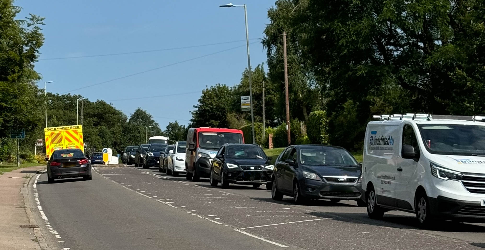
Anyone that lives here knows about the existing traffic congestion on the B197 and residential streets. This has been highlighted in various Knebworth village plans over the years, including most recently Knebworth Neighbourhood Plan. In November 2024, I highlighted the decade of dithering around A1(M) capacity improvement at the District Council meeting and supported motion which was passed to lobby government and MPs to do something about this.
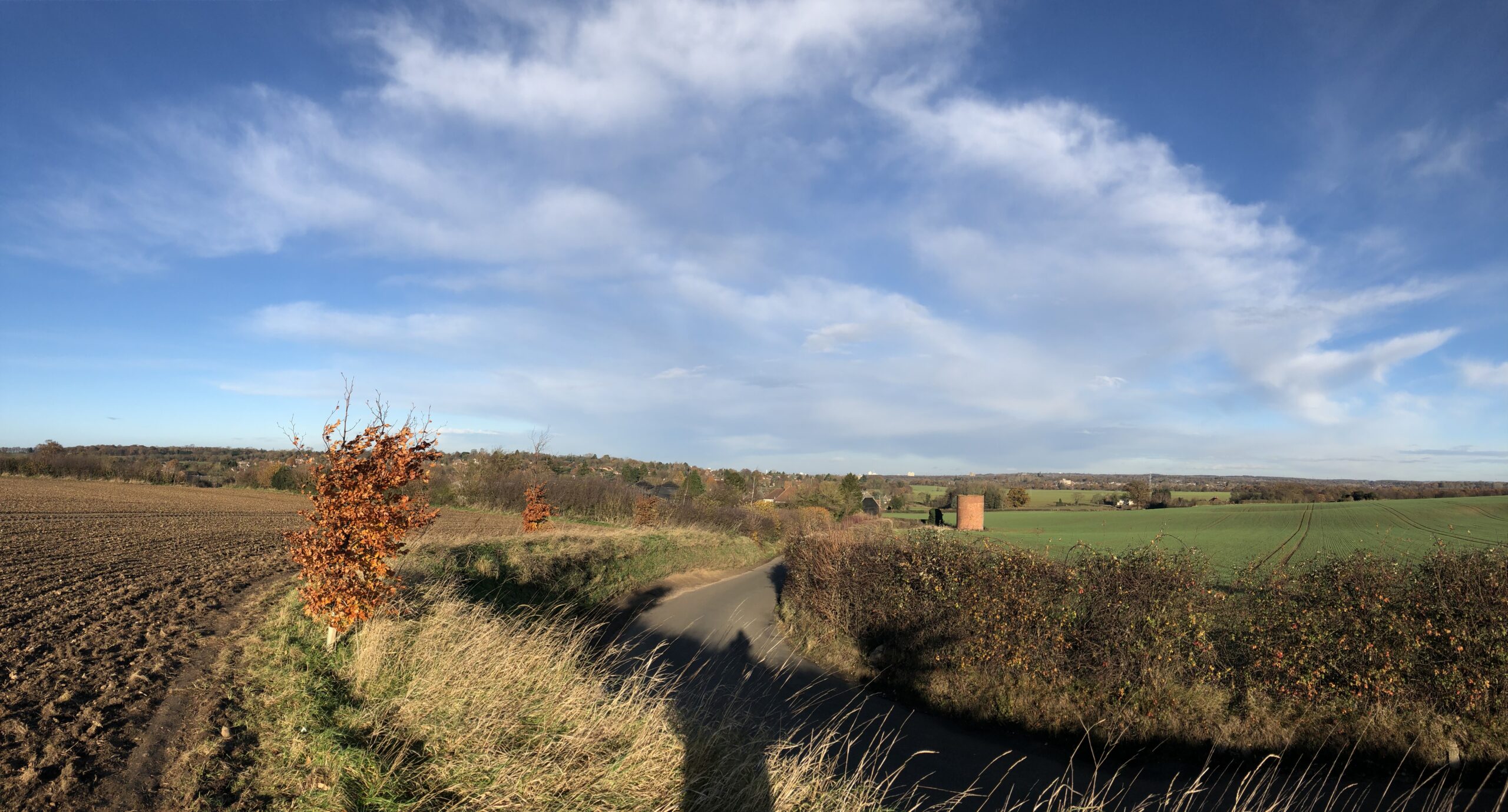
The roads in and around Knebworth are historic and were never designed to cope with the large size of village we have today (about 4,500 people and 2,000 homes), never mind at least one third increase with the current Local Plan sites or potential future growth beyond that. The train line also causes issues for safe access East / West.
The combined impact of A1(M) overflow and the existing poor road network for walking, cycling and vehicles means that we need a proper integrated strategy for the future. Herts County Council’s Highways team, the District Council’s planning team and Developers need to address the overall transport infrastructure needs of an expanded village, and design solutions for the rest of this century at least.
We also have a climate emergency and should recognise that we also need to be promoting walking, cycling and use of public transport. I promote measures that encourage walking and cycling for people within the village wherever possible, particularly trips to the local schools, shops and train station. We should not use our cars when we don’t have to when we have a realistic alternative option.
However, this has to be balanced with the reality of residents needing to use cars to get further afield. We live in a semi-rural environment, not a city, and our bus and train services are simply not at a level that means there is no need to use cars. Also, we must not forget people with accessibility issues cannot be expected to walk miles to the doctors’ surgery for example.
Development provides an opportunity to address this
The current proposals for new developments around Knebworth are rightly including improvements to cycling and walking. However, as they stand they will not deliver any improvements to our road network to cope with an expanded community and existing congestion.
We know that from the published plans for KB4 (see below links), traffic to and from Datchworth will be diverted through the new development and Watton Road straight into the village centre. We also know from the latest developer consultations (see links below) that sites KB1 & 2 are likely to be cul-de-sac developments of hundreds of houses ending in T junctions onto Park Lane. This will all just exacerbate the congestion in the village centre in the area between the train station and shops, plus access to a new primary school on KB2.
We need pragmatism to deliver growth in Knebworth that works for residents today
Indeed, the County Highways Design Guidance states that a “certain level of congestion may be desirable” when planning access from new developments and it deters sites with multiple entry points for vehicles. This is not new news for those that follow other Local Plan developments in the district, as it is driven by county-wide transport policy. For example the Great Ashby masterplan (site GA2) has 600 homes and a new school all being accessed by vehicles via one long road culminating in a T junction.
In the case of Knebworth, I believe that more impact is unacceptable. We need solutions that will provide reasonable local access routes for our residents to get in and out of the village without always going through the village centre. This is also a position supported by the Parish Council in principle. However I know that the highways teams are concerned of creating “induced load” and by building more roads creating a more attractive route along the B197 for through traffic, attracting more traffic off the A1(M) and through Knebworth.
However, whilst I am certainly not a highways professional, I believe that there must be a way to design access for the new Knebworth sites that makes it not attractive for through use but helps mitigate the impact for the local residents who just want to be able to get in and out of the village.
We must plan for the future beyond this Local Plan (to 2031)
We also need the road layout to have an eye on future development beyond the current sites. For example, one specific area of concern is the proposed site of a secondary school north of Watton Road, in addition to the proposed houses there. We need infrastructure planning now to support future school buses and other vehicles to support a secondary school.
To the west site, the primary issue is crossing the railway line to access the B197. There are various possibilities that should be investigated rather than forcing all traffic down unsafe narrow areas where vehicles meet pedestrians and cyclists like the station tunnel, Deards End Lane and Gun Lane. The below sketch is one example of some ideas that I believe should be openly analysed and discussed between the public, developers and authorities.
Ideas for local access routes – not what is currently proposed

But I do not want to encourage more traffic into Knebworth by building an M25-style A1(M) bypass. There is a reasonable compromise to be had to make the lives of residents here sustainable and encourage use of cycling and walking locally. However, we need the co-operation of all the above parties – local authorities, land owners and developers – to work together to achieve this across sites during the Masterplanning and Planning Application processes. There will be significant money available from the housing developments that could be invested in new road infrastructure as well as needed improvements for cycling and walking.
Without this, there is a strong risk that the village will grind to a halt with more and more development layered on top over the next decades without the necessary transport infrastructure across all modes of transport – including vehicles – to support a growing semi-rural community.
Have your say now via consultations
This may be a divisive issue; compromises need to be made between principles and practicality. Therefore, I urge everyone in the village to get interested in this topic over the next few months. Please engage with the consultation processes run by developers and the District Council as the local planning authority on sites KB1, 2 and 4 to make your views known, as well as with consultation on updates to the Knebworth Neighbourhood Plan via the Parish Council.
Further reading
Knebworth Neighbourhood Plan
Site KB4: Planning application 23/01552/OP Land South Of Watton Road Knebworth Hertfordshire
“Outline planning permission for up to 200 dwellings (including affordable housing), structural planting and landscaping, informal public open space and children’s play area, surface water flood mitigation, vehicular access point and associated ancillary works. All matters reserved except for means of access”
The Movement and Access Framework map showing the access is here:
Sites KB1 & 2: Land West of Knebworth
Developer consultation website:
with an illustrative strategic masterplan showing the expected access:
http://knebworth-strategicmasterplan-kb1kb2.co.uk/proposals/
Hertfordshire Highways’ Highways Place and Movement Planning and Design Guide can be found here:
Part 2 (page 92) contains design guidance for new developments, specifically related to access points, thus:
“10.5 Additional accesses for cars into the development from the existing network will only be considered where the development can clearly demonstrate that after all the measures to support sustainability have been implemented an unacceptable impact remains because of the residual vehicle-based trips. Congestion on its own will not be reason enough, indeed a certain level of congestion may be desirable to encourage the desired mode share in favour of sustainable modes of transport.”
Site GA2: Great Ashby Masterplan
https://www.north-herts.gov.uk/north-east-great-ashby-masterplan
RELATED POSTS
View all
August update: KB4 deferment, recycling, hedges
August 17, 2025 | by Paul Ward

Draft masterplans for west Knebworth reflect our character but need better access and facilities
January 25, 2025 | by Paul Ward
Roads: compromise is needed now on highways solutions to support housing growth and address current issues for residents
October 28, 2025 | by Paul Ward